01
Protect the site evidence
Roads, water, boundaries, north and neighboring buildings hold their source positions. Name each one.
14 reviewed prompts
Every early concept answers one question first: does it fit the site? These prompts start from an aerial photo, a satellite capture or a white massing model. Roads, boundaries and neighbors stay where they are. One clear massing move goes in, and you judge it against real context.
01
Roads, water, boundaries, north and neighboring buildings hold their source positions. Name each one.
02
Courtyard, bar, cluster or perimeter block. One concept per image, tested honestly.
03
Place arrival, service and pedestrian routes before planting or facades. A concept without access is sculpture.
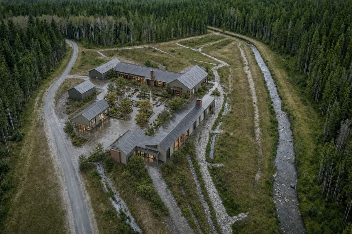
Explore a woodland arts library and sheltered reading court on a fixed site image.
Preserve the source oblique viewpoint and the geometry of the access road, tree line, stream, drainage swales, setback strips, two retained pitched pavilions, and linear stone plinths; add architecture only within the existing woodland clearing. Transform the fictional base into a rain-darkened arts library with compact reading pavilions around a sheltered garden court. Use rational timber bays, brick archive cores, mineral-painted cladding, dull zinc roofs, deep covered thresholds, oak-framed windows, and stone channels linking roof runoff to planted swales. Keep the stream, mature trees, and wet ground visually dominant. Use high overcast light without changing the source framing, and resolve the output as one materially detailed photoreal architectural visualization with the library court as its spatial center. Show no people; do not generate a crowd, queue, group, gathering, or human silhouettes. Keep every addition outside the drainage setbacks. This is concept visualization, not planning, dimensional, engineering, regulatory, or construction evidence.
Compare a Jakarta climate-learning campus, water court, and phased growth on a fixed site base.
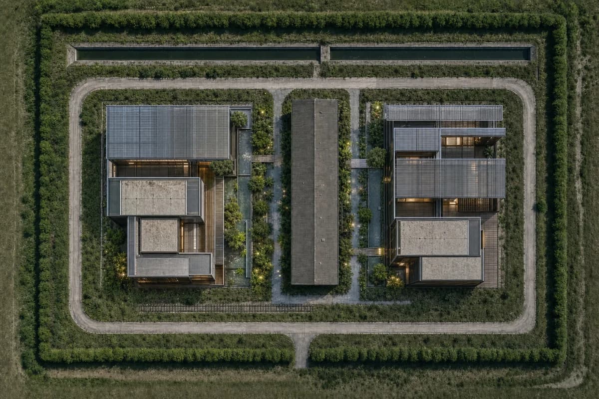
Preserve the source top-down viewpoint, orientation, crop, and the geometry of every perimeter route, vacant slab, drainage channel, long retained pavilion, short linear trace, and planted boundary exactly. Add new buildings only within the two clearly defined vacant slab zones. Transform the fictional base into an adaptable climate-learning campus in Jakarta with a monsoon library, materials gallery, shaded seminar rooms, and a legible overhead environmental spine. Use recycled aluminum, low-carbon concrete, translucent service panels, timber cassettes, deep external shading, replaceable components, and blue-green ceramic rain channels. Use crisp post-rain morning light without changing the source framing; organize the retained pavilion and two new wings around a central water garden so the spatial hierarchy reads immediately. Keep the entire site unoccupied. Show no people; do not generate a crowd, queue, group, gathering, or human silhouettes. Do not erase surface traces or invent routes beyond the source. Show no readable text, signs, logos, lettering, boards, or numbers. This is a materially resolved photoreal concept visualization, not planning, dimensional, engineering, regulatory, or construction evidence.
Communicate civic infill relationships from a fixed fictional base map.
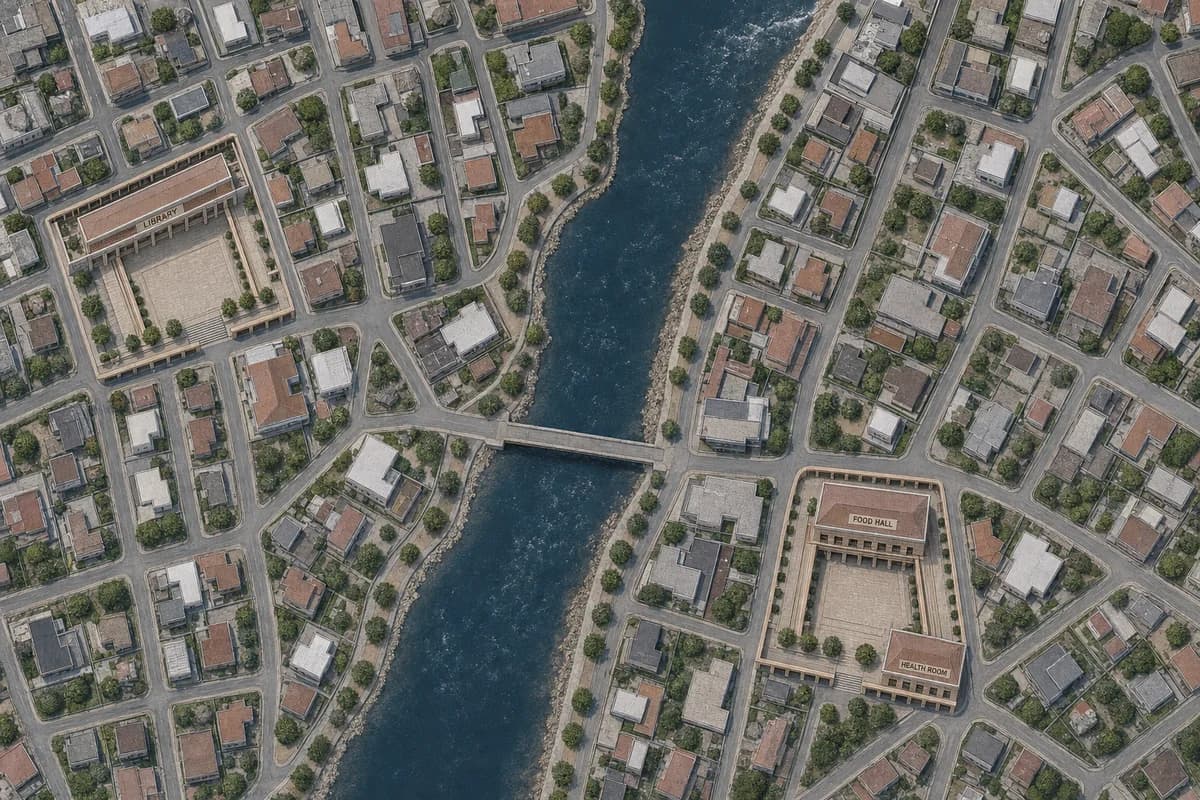
Preserve the source top-down viewpoint and the geometry of every street, parcel, existing footprint, riverbank, river path, bridge, and tree; add civic buildings only within the vacant municipal parcels. Convert the fictional map into a materially resolved photoreal orthographic top-down civic-center concept. Add a library, health room, food hall, and sheltered square within those parcels using colonnades, loggias, broad stairs with ramps, durable brick, architectural precast, regional stone, and timber handrails. Keep the ordinary neighboring fabric legible, with the square as the primary void, the colonnade as its continuous edge, and the river path as a clear secondary route. Use calm seasonal daylight. Show no people; do not generate a crowd, queue, group, gathering, human silhouettes, or transit activity. Avoid perspective and ceremonial composition. This is concept visualization, not planning, dimensional, engineering, regulatory, or construction evidence.
Review reversible music-academy additions against a fixed Porto cloister campus image.
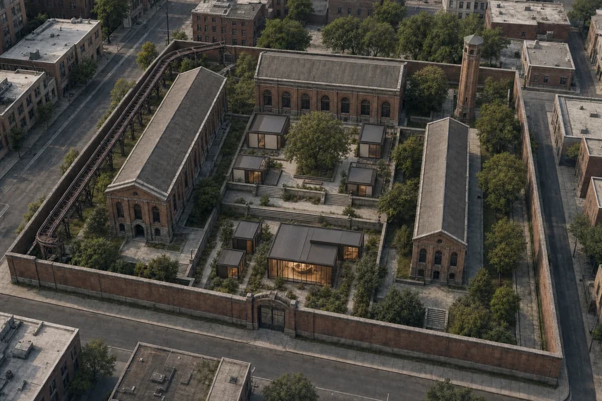
Preserve the source oblique viewpoint, crop, and the geometry of every brick hall, tower, elevated linear bridge, stone terrace, perimeter wall, gate, path, mature tree, and surrounding block exactly. Add new volumes only within the two existing open courts. Transform the fictional Porto cloister campus into a music academy with freestanding rehearsal rooms, a recital salon, instrument library, and listening pavilion in darkened steel, reused timber, dry connections, acoustic plaster, glass, and lime-repaired masonry. Keep emergency access on the original perimeter route and compose the two courts as distinct stone and planted rooms linked by the retained bridge. Use oblique afternoon daylight without changing the source aerial angle, with the recital salon as the warm spatial anchor and the retained masonry remaining dominant. Keep the entire scene unoccupied. Show no people; do not generate a crowd, queue, group, gathering, audience, or human silhouettes. Avoid picturesque ruin effects and wholesale cleaning. Do not alter, cover, or extend any retained element. Show no readable text, signs, logos, lettering, boards, or numbers. This is a materially resolved photoreal concept visualization, not planning, dimensional, engineering, regulatory, or construction evidence.
Assess a vertically stacked civic climate library and public garden rooms on a fixed urban reservoir terrace.
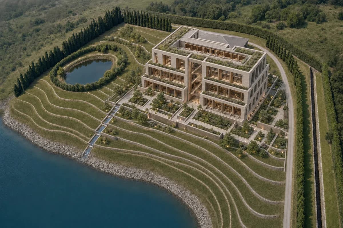
Preserve the source oblique viewpoint, crop, and the geometry of every planted boundary, drainage channel, access lane, existing pitched pavilion, reservoir, contour, and vacant paved terrace exactly. Create an architecture-first urban civic composition only on the vacant terrace: a compact five-storey municipal climate library with a flat inhabited roof, a tall daylit stair hall, a double-height city reading room, stacked children’s library and civic archive floors, a council chamber, and a roof reading salon. Give the building a clear vertical silhouette and a finely articulated street wall along the access lane, using pale load-bearing brick, board-marked low-carbon concrete, bronze-anodized window frames, deep oak-lined reveals, glazed ceramic rain channels, and generous loggias. Convert the remainder of the terrace from an exposed paved expanse into fine-grained public garden rooms with small planted courts, reading terraces, seat walls, rain gardens, and a narrow water stair descending visually toward the reservoir; keep the retained pitched pavilion visibly separate and subordinate. Set diffuse cloudy morning light without changing the source framing, and resolve one beautiful materially detailed photoreal architectural visualization in which the civic stair hall, layered interiors, garden rooms, and urban lane edge are immediately legible. Do not generate single-storey bars, gabled additions, shed or barn proportions, broad hardstand or gravel courts, service compounds, or loading geometry. Keep the site entirely unoccupied while boundary planting and reservoir water move lightly. Show no people; do not generate a crowd, queue, group, gathering, or human silhouettes. Do not alter any source terrain, water, route, retained building, or boundary. Show no readable text, signs, logos, lettering, boards, or numbers. This is concept visualization, not planning, dimensional, engineering, regulatory, or construction evidence.
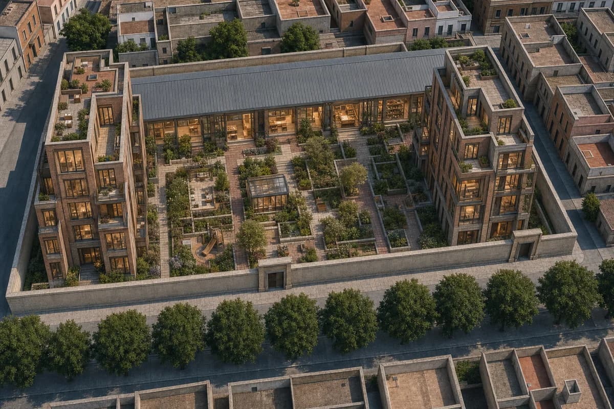
Explore six-storey circular housing, neighborhood civic rooms, and fine-grained residential gardens on a constrained urban block.
Preserve the source oblique viewpoint, crop, and the geometry of the long civic hall, perimeter walls, street trees, neighboring buildings, two access points, and broad paved court exactly. Create an architecture-first residential city block by placing one compact six-storey apartment house in each vacant court-edge zone. Shape both houses as upright, stepped volumes with flat inhabited roofs, narrow vertical bays, projecting winter gardens, recessed balconies, and clearly expressed stair towers; give the street-facing house a strong masonry address and the inner house a sequence of domestic stoops. Convert the retained civic hall internally into a double-height neighborhood library, childcare ateliers, and a residents’ dining room opening toward the center. Replace the court’s exposed hardstand character with fine-grained residential garden rooms: small planted terraces, rain gardens, brick paths, play niches, seat walls, and a shared glass garden room, while retaining its exact perimeter and both access points as quiet pedestrian passages with discreet integrated fire access. Use reclaimed brick, warm architectural precast, bolted reclaimed-steel frames, timber window cassettes, recycled bronze-toned panels, and dry-jointed stone paving. Set clear late-afternoon daylight without changing the source framing, and resolve one beautiful materially detailed photoreal visualization in which apartment interiors, balconies, stair towers, the civic rooms, and the layered residential gardens make the urban domestic program unmistakable. Do not generate single-storey bars, gabled additions, shed or barn proportions, broad hardstand or gravel courts, service compounds, or loading geometry. Keep all exterior and visible interior spaces unoccupied. Show no people; do not generate a crowd, queue, group, gathering, family scene, or human silhouettes. Make structural reuse and step-free access legible without salvage clutter. Do not alter or conceal any retained source element. Show no readable text, signs, logos, lettering, boards, or numbers. This is concept visualization, not planning, dimensional, engineering, regulatory, or construction evidence.
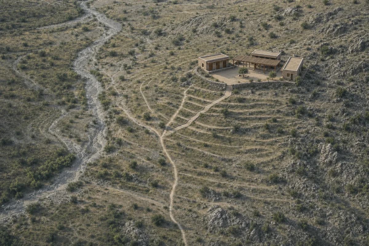
Study a bioregional school footprint against fixed dryland features.
Preserve the source oblique viewpoint and the geometry of the seasonal wash, contours, rock outcrops, existing path, sparse trees, and erosion channels; add the learning center only on the level empty terrace. Make its educational program visually legible through three sheltered rammed-earth classrooms, repeated classroom doors, a shaded teaching court, and a clear accessible arrival from the existing path. Use modest openings, clear timber lintels, deep caps, protected local-stone bases, lime repairs, and simple roof catchments. Keep every terrain feature and water route unchanged, with sparse planting. Use dry diffuse light with neutral earth color without changing the source framing, and render one materially resolved photoreal architectural visualization with the shaded court as the dominant void. Show no people; do not generate a crowd, queue, group, gathering, class, or human silhouettes. Avoid resort cues. This is concept visualization, not planning, dimensional, engineering, regulatory, or construction evidence.
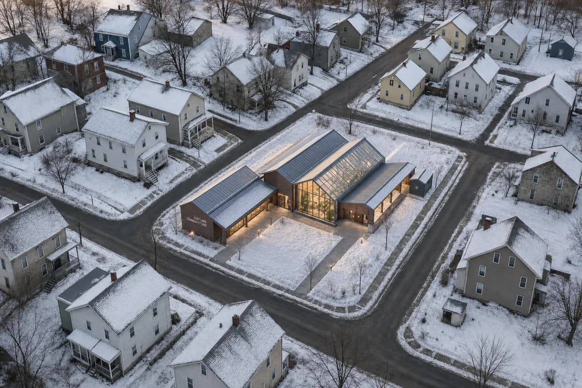
Visualize a shared winter facility within a fixed village layout.
Preserve the source oblique viewpoint and the geometry of every house, road, sidewalk, tree, slope, snowbank, and utility pavilion; add the community link only within the vacant central plot. Place a compact mobility room, parcel counter, winter garden, and covered arcade in that plot, connecting the two existing sidewalks. Use robust brick, thermally modified timber, zinc, translucent insulated panels, deep vestibules, and credible snow-shedding roofs. Use low winter sun with blue ambient fill and restrained warm interiors without changing the source framing, and resolve the architecture photorealistically with the winter garden as a luminous but restrained center between heavier brick wings. Show no people; do not generate a crowd, queue, group, gathering, or human silhouettes. Keep all roads vehicle-free, and keep plow routes, snow storage, and ramps clear. This is concept visualization, not planning, dimensional, engineering, regulatory, or construction evidence.
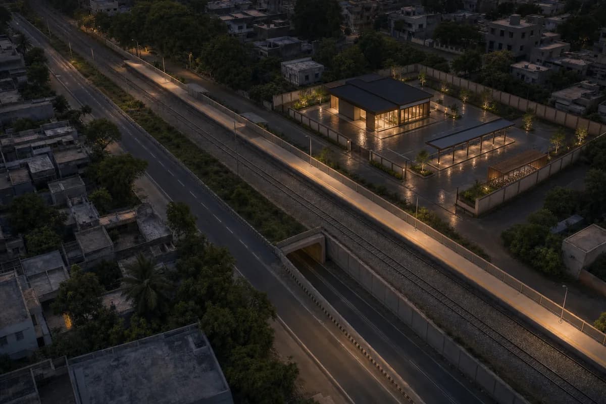
Night concept review for a fixed rail-edge access arrangement.
Preserve the source oblique viewpoint and the geometry of the tracks, platform, road, underpass, neighboring blocks, boundary wall, and mature trees; add the mobility hub only within the vacant rail-edge parcel. Place a sheltered station room, bus canopy, bicycle store, and small square in that parcel. Use dark masonry, matte metal, clear glass, protected timber, and localized wet paving. Light only entrances, paths, platform access, and waiting areas with practical warm fixtures. Keep the source framing and dark sky, resolving one photoreal night visualization with the station room as the primary pool of light and the platform and underpass held in legible shadow. Show no people; do not generate a crowd, queue, group, gathering, or human silhouettes. Include no bus, train, bicycle movement, or road traffic. Avoid luminous branding and facade floodlighting. This is concept visualization, not planning, dimensional, engineering, regulatory, or construction evidence.
Explore low-impact access on a fixed fictional wetland base.
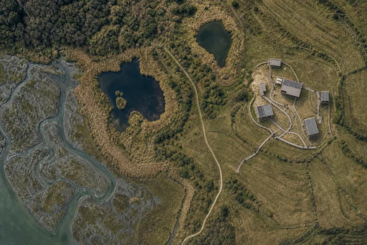
Preserve the source top-down viewpoint and the geometry of every tidal channel, pond, reed bed, woodland edge, field boundary, contour, existing track, and dry-ground patch; add the research gateway only on the largest dry patch. Place low separated pavilions on that patch and link them with raised walks that follow the shown contours. Use weathered timber, local stone, recycled aluminum, limecrete, and modest protected foundations. Keep hydrology and restoration vegetation dominant. Use changeable high cloud without changing the source framing. Show a few researchers on designated paths while water and reeds move. Do not beautify or densify the habitat. This is concept visualization, not planning, dimensional, ecological, engineering, regulatory, or construction evidence.
Explore a sunny coastal arts campus on fixed Tasman site geometry.
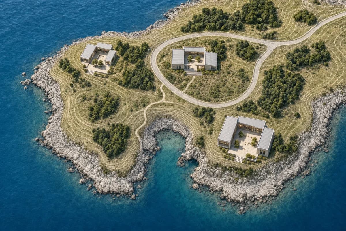
Preserve all source geometry, camera position, oblique aerial projection, crop, and layout exactly. Add a compact coastal arts campus only within the three vacant source pads, keeping the shoreline, inlet, access loop, footpath, contour bands, tree clusters, rock edges, and every retained footprint fixed. Form three low courtyard pavilions for studios, a gallery, and a small performance room using local stone, pale timber, recycled aluminum, clear glass, and light-colored paving. Set the output beneath a bright, sunny, clear blue sky with warm direct afternoon sunlight and crisp sunlit shadows defining the pavilions and courts. Keep the entire site unoccupied while the inlet water and existing foliage move lightly. Do not alter, conceal, extend, or relocate any source route, terrain feature, vegetation cluster, water edge, or retained building. Show no readable text, signs, logos, lettering, boards, or numbers.
Study a sunny civic reading court within a fixed Marrakesh urban parcel.
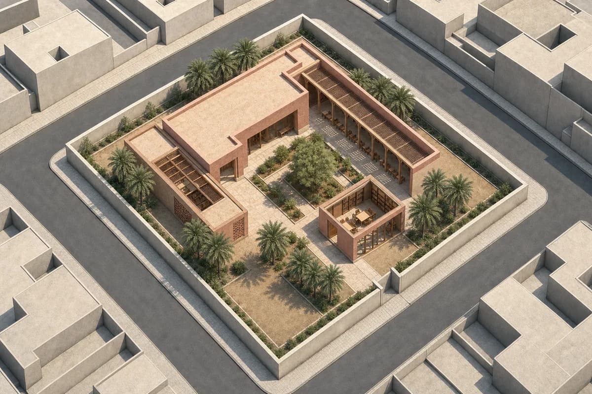
Preserve all source geometry, camera position, oblique aerial projection, crop, and layout exactly. Add a civic reading court only within the vacant central parcel, keeping every perimeter street, neighboring footprint, boundary wall, access path, palm cluster, planted strip, and ground edge in its exact source position. Compose a library pavilion, shaded reading loggia, children’s room, and small lecture room around one planted court using rose-toned masonry, lime plaster, carved timber screens, local stone, and clear glass. Set the output beneath a bright, sunny, clear blue sky with warm direct morning sunlight and crisp sunlit shadows under the loggia and screens. Keep all exterior and visible interior spaces unoccupied. Do not add, remove, move, resize, cover, or reinterpret any retained source element. Show no readable text, signs, logos, lettering, boards, or numbers.
Explore a colorful, refined Dakar design campus on a fully preserved fictional coastal site.
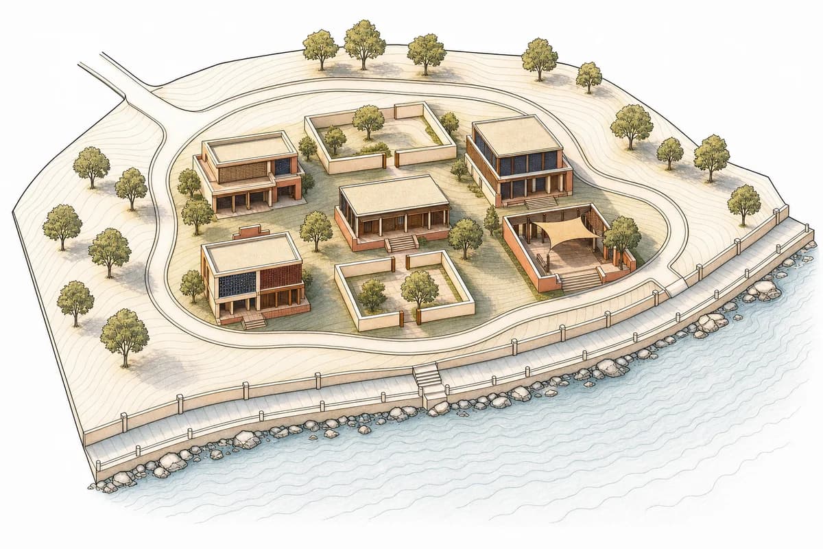
Preserve all source geometry, camera position, oblique aerial projection, crop, and layout exactly. Add an exquisite upscale design campus only within the four vacant source pads, keeping every shoreline edge, promenade, access loop, contour, retained pavilion, courtyard wall, tree cluster, and water basin in its exact source position. Compose a textile gallery, design library, teaching salon, and shaded event court as a family of refined two- and three-storey volumes with shell-lime plaster in muted coral and sand, deep indigo glazed ceramic screens, russet laterite, dark iroko joinery, woven shading panels, and sparing bronze-toned details. Use clear golden-hour light to make the courts warm, inviting, and richly layered while the architecture remains disciplined and believable. Keep the entire campus unoccupied as the water and foliage move lightly. Do not alter, conceal, extend, resize, or relocate any retained source element. Exclude ostentation, kitsch, clutter, garish color, excessive ornament, and over-scaled gestures. Show no readable text, signs, logos, lettering, boards, or numbers.
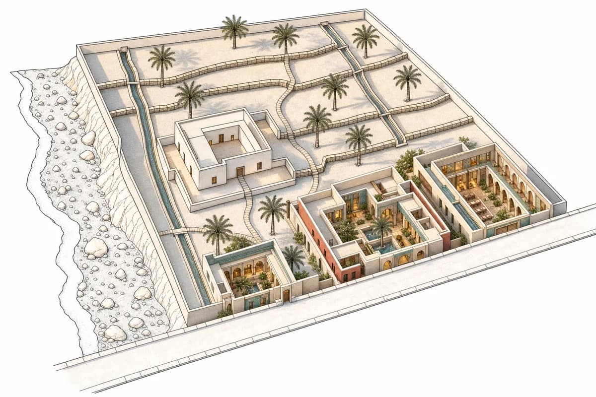
Visualize a colorful, exquisite Muscat research campus within a completely preserved oasis layout.
Preserve all source geometry, camera position, oblique aerial projection, crop, and layout exactly. Add a beautifully restrained upscale climate-research campus only within the three vacant source plots, keeping every wadi edge, irrigation channel, access street, footpath, terrace line, retained courtyard house, date-palm cluster, and garden wall fixed. Arrange a climate library, research rooms, exhibition salon, and shaded forum around linked garden courts in pale Omani limestone, muted pomegranate and sea-green lime plaster, turquoise glazed ceramic accents, carved timber screens, warm terrazzo, and finely detailed bronze-toned frames. Use clear warm golden-hour light beneath deep arcades, creating cozy luminous interiors and elegant shaded courts without spectacle. Keep all exterior and visible interior spaces unoccupied while channel water and palm fronds move lightly. Do not add, remove, cover, move, resize, or reinterpret any retained source geometry. Exclude ostentation, kitsch, clutter, garish color, excessive ornament, and monumental gestures. Show no readable text, signs, logos, lettering, boards, or numbers.
Site photo to render is the fastest honest test of an early idea. An aerial or satellite image carries real edges, real access and real neighbors. Keeping them fixed makes the concept accountable from the first image.
A white massing model works as a source the same way. Render it in context before a planning application or a client review. If the move fails against the real site, better to see it now.
Jump to another corner of the library. Browse by building program and place, or by workflow and treatment.