01
Lead with the subject
Put the focus of this view first and let the rest of the scene support it.
25 reviewed prompts
Prompts lose their subject when everything competes for attention. These briefs put aerials first, frame the view to keep it legible, and hold real construction so the emphasis stays honest.
01
Put the focus of this view first and let the rest of the scene support it.
02
Choose a camera, height and lens that make the focus legible from the right distance.
03
Hold real structure, joints, drainage and tolerances so the emphasis never drifts into fantasy.
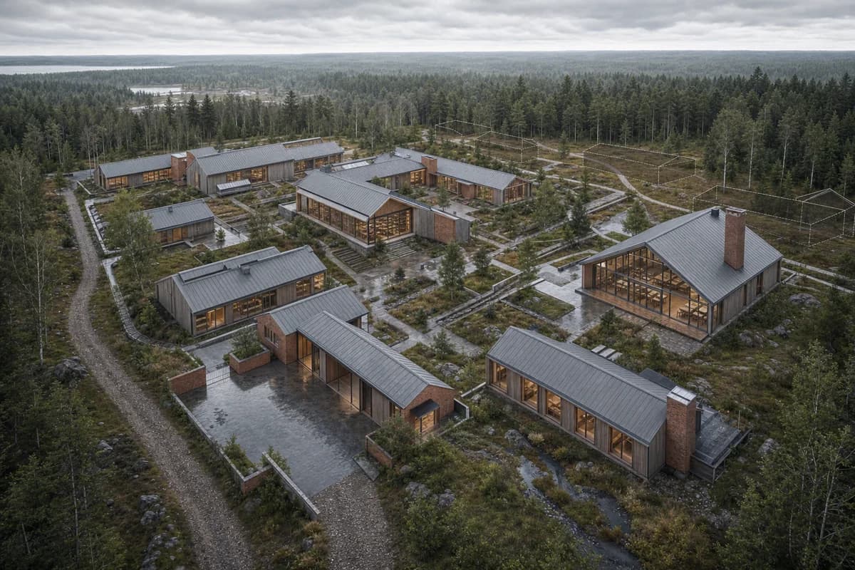
Campus option review focused on research massing, drainage, and phased growth.
Create an unoccupied oblique aerial concept visualization of a contemporary woodland research campus in a northern landscape. Arrange compact pitched-roof laboratories, a shared library, and a seminar pavilion around sheltered courts, with rational timber bays, brick service cores, dull zinc roofs, deep thresholds, and one retained gravel route. Show rain-darkened clearings, bioswales, a small arrival court, and phased edges rather than manicured parkland. Use high overcast light with open neutral shadows and frame a calm medium-altitude view looking across the campus toward dense woodland. Keep every path, court, terrace, road, and interior visible through glazing free of people and vehicles. Make circulation, topography, drainage, and future expansion coherent. Show no readable text, signs, logos, lettering, boards, or numbers. This is concept visualization, not planning, dimensional, engineering, regulatory, or construction evidence.
Massing and systems review for a phased research campus.
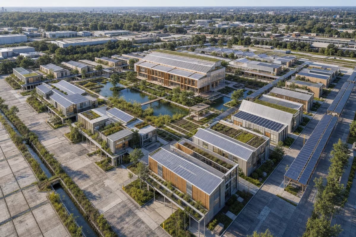
Create an unoccupied materially resolved photoreal oblique aerial concept visualization of an adaptable environmental research campus on a former paved urban site. Organize modular laboratories, a shared library, shaded service spines, test gardens, and transit shelters in clear expandable bands around one central planted water court. Use demountable timber cassettes, recycled aluminum, low-carbon concrete, translucent polycarbonate halls, and maintained panel variation. Retain part of the existing slab and drainage network. Use crisp morning light. Frame a moderate-altitude oblique aerial with a straight horizon, making the library and water court the compositional center, laboratory bands the secondary order, and retained drainage the landscape armature. Show no people; do not generate a crowd, queue, group, gathering, researchers, or human silhouettes. Include no bicycles, shuttles, deliveries, or moving vehicles. Keep utilities, discreet servicing, and future expansion legible without spectacle. This is concept visualization, not planning, dimensional, engineering, regulatory, or construction evidence.
Public consultation image for civic connections, accessibility, and shared open space.
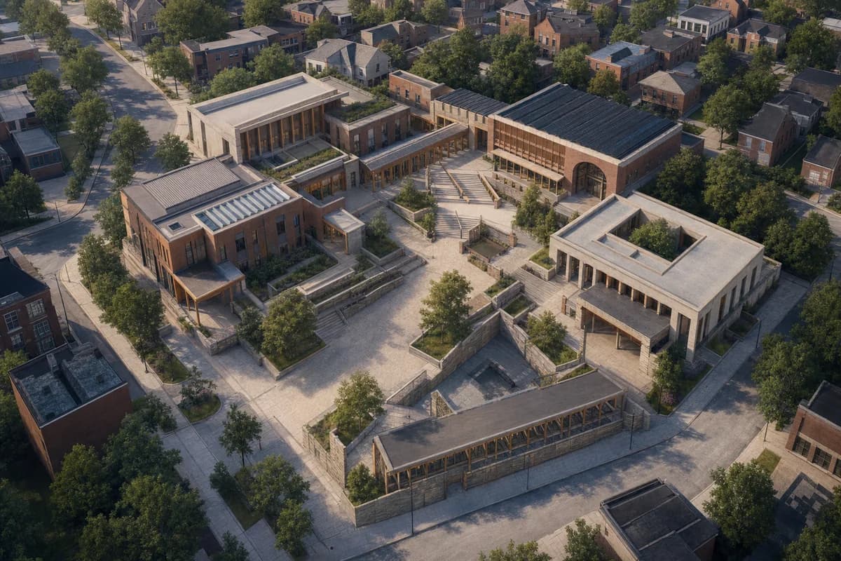
Create an unoccupied oblique aerial concept visualization of a connected small-city civic quarter linking a library, school, health center, market hall, and transit street. Shape a sequence of courtyards, loggias, broad stairs with integrated ramps, shaded waiting edges, and unmistakable public entrances. Use robust brick, architectural precast, regional stone, timber handrails, and restrained evidence of weathering. Retain the surrounding street grain and mature trees. Set calm seasonal daylight with clear thresholds and frame a medium-altitude view that shows walking routes from adjacent neighborhoods into the shared square. Keep streets, paths, terraces, steps, and visible rooms entirely free of people, bicycles, and vehicles so the spatial connections remain primary. Avoid heroic symmetry and show no readable text, signs, logos, lettering, boards, or numbers. This is concept visualization, not planning, dimensional, engineering, regulatory, or construction evidence.
Adaptive reuse review for retained fabric, cultural programs, and reversible additions.
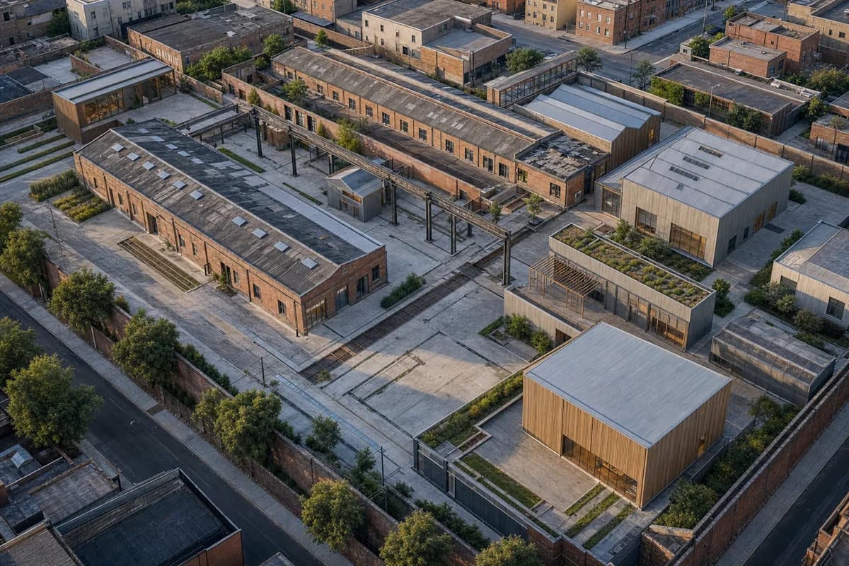
Create an unoccupied oblique aerial concept visualization of a former municipal maintenance compound adapted into a mixed civic arts district. Retain long brick halls, concrete aprons, gantry traces, service alleys, patched roofs, and established enclosure walls. Insert freestanding timber and galvanized-steel volumes for galleries, rehearsal rooms, an archive, and community classrooms using reversible connections. Let new courts follow the existing drainage geometry while planted slots soften only selected edges. Use oblique afternoon daylight to reveal old and new layers and frame a moderate aerial view that includes surrounding ordinary blocks. Keep every court, route, terrace, roof, and visible room free of people and vehicles. Make fire access, step-free circulation, and retained fabric credible without picturesque decay. Show no readable text, signs, logos, lettering, boards, or numbers. This is concept visualization, not planning, dimensional, engineering, regulatory, or construction evidence.
Aerial option review for coastal research massing, shelter, and water management.
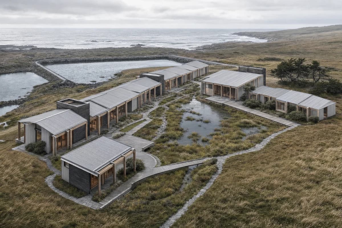
Create an oblique aerial concept visualization of a contemporary coastal observatory campus on a low headland. Arrange a linear weather gallery, two compact research pavilions, a shared library, and sheltered sleeping courts around a long rain garden that drains toward an existing tidal basin. Use repeated timber portal frames, pale fiber-cement cladding, dark brick service cores, corrugated aluminum roofs, board-marked concrete, and weathered stone paths. Set a cloudy morning with low coastal contrast and frame a medium-altitude view across wind-shaped grasses toward the water. Keep the campus unoccupied while grasses and the basin surface move lightly. Make topography, accessible circulation, roof drainage, wind shelter, and phased expansion legible. Avoid nautical decoration and show no readable text, signs, logos, lettering, boards, or numbers. This is concept visualization, not planning, dimensional, engineering, regulatory, or construction evidence.
Competition image for housing phasing, component reuse, and neighborhood connections.
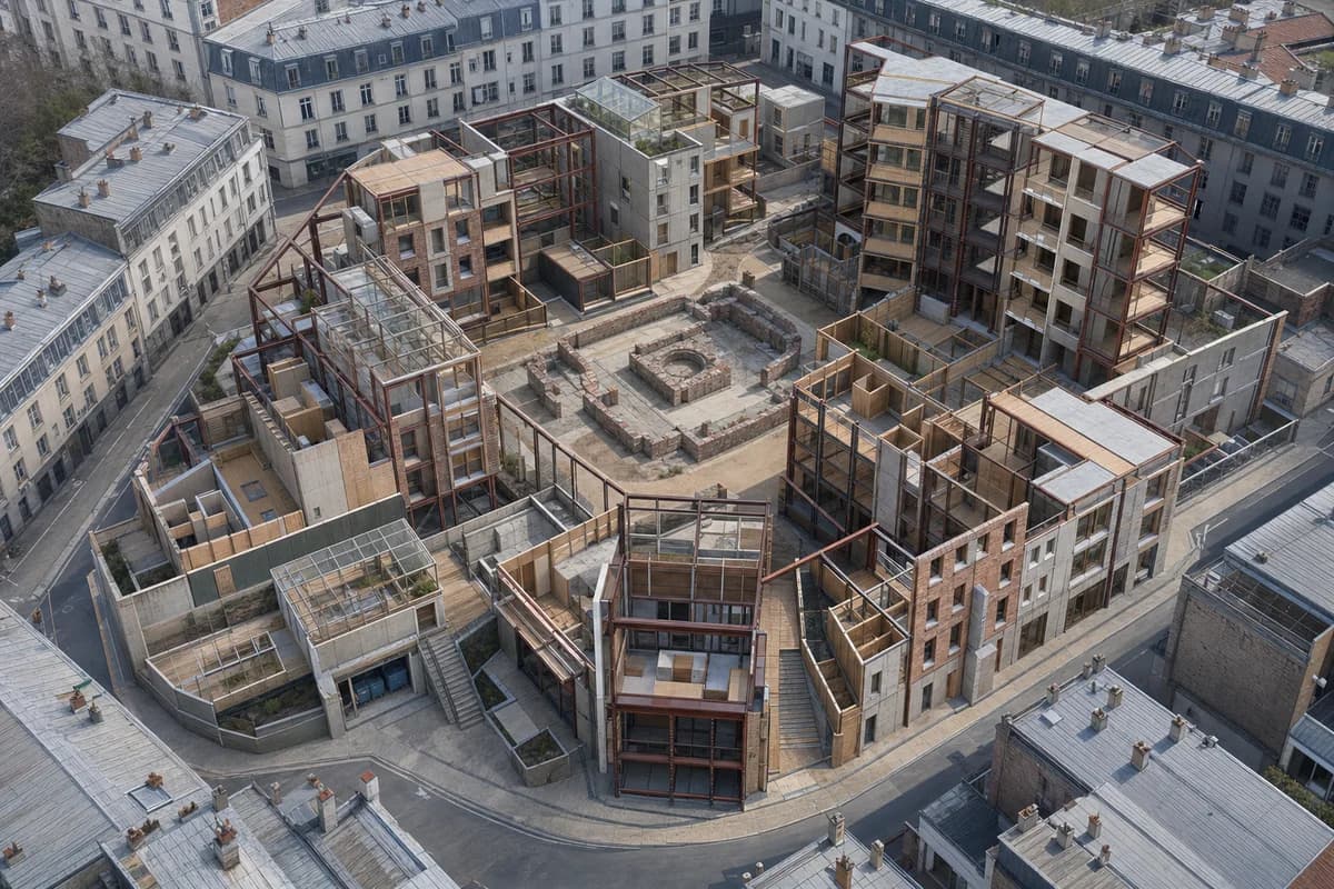
Create an unoccupied oblique aerial concept visualization of a circular-construction housing quarter inserted among existing perimeter blocks. Organize mid-rise apartments, a childcare room, shared winter gardens, resident storage, and quiet courts around retained foundations. Use bolted reclaimed-steel frames, standardized facade panels, reused brick batches, timber decks, removable infill, and accessible service zones. Preserve abstract component wear without legible marks and make dry joints readable at selected building edges. Set clear workday daylight and frame a moderate-altitude whole-district view that keeps adjacent streets and roofs visible. Keep all courts, balconies, streets, paths, and visible rooms free of people, bicycles, and vehicles. Show phased construction logic without using greenery as proof of performance. Show no readable text, signs, logos, lettering, boards, or numbers. This is concept visualization, not planning, dimensional, engineering, regulatory, or construction evidence.
Concept communication for institute massing and water-sensitive landscape structure.
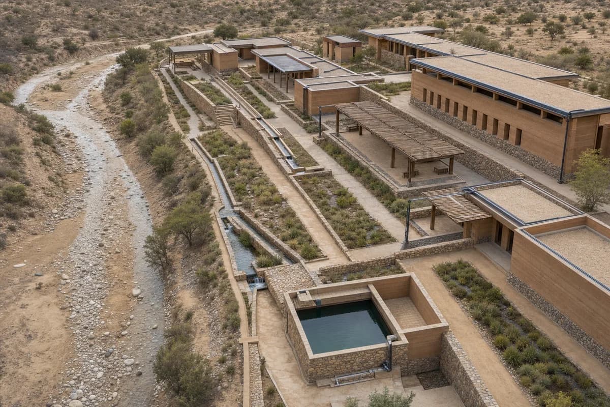
Create an unoccupied oblique aerial concept visualization of a dryland water institute beside a seasonal wash. Arrange thick earth laboratories, an archive, shaded seminar courts, simple roof catchments, stone channels, infiltration gardens, and a protected cistern in disciplined bands that follow the contours. Use rammed earth, compressed earth block, lime, local stone, timber, and visibly protected wall bases. Keep planting sparse and directly tied to drainage. Use dry diffuse light with neutral earth color and frame a medium-altitude view that clearly shows the wash, contour paths, wall bases, and the complete collection sequence. Keep every court, terrace, path, roof, and visible room free of people and vehicles. Make overflow routes, accessible gradients, erosion protection, and shade structures plausible. Avoid resort imagery and show no readable text, signs, logos, lettering, boards, or numbers. This is concept visualization, not planning, dimensional, engineering, regulatory, or construction evidence.
Housing-quarter review focused on winter access, shared rooms, and snow storage.
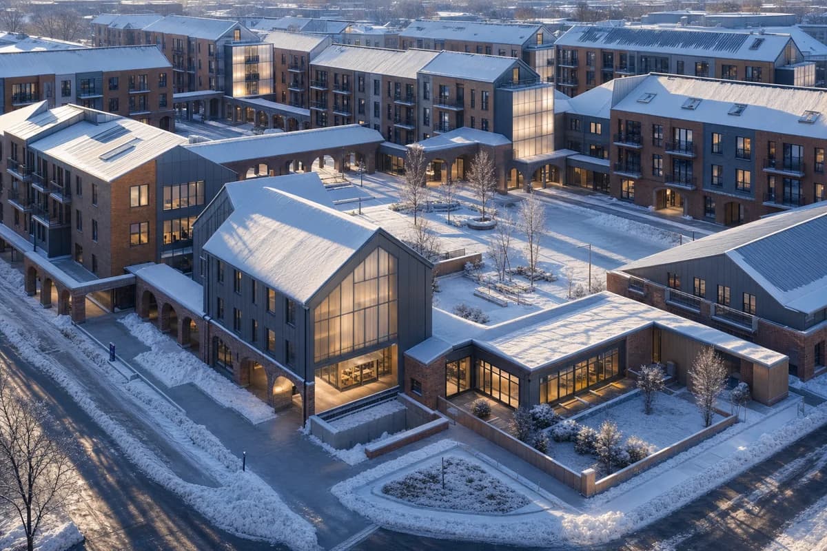
Create an unoccupied oblique aerial concept visualization of a compact cold-climate housing quarter organized around protected winter routes. Use perimeter apartments, enclosed arcades, deep vestibules, shared winter gardens, a childcare room, a mobility room, and roofs shaped for credible snow shedding. Build with robust brick, thermally modified timber, zinc, and translucent insulated panels. Show plowed streets, designated snow-storage zones, clear ramps, sheltered pedestrian links, and realistic roof-fall clearances. Set low winter sun with blue ambient fill and restrained warm interiors, then frame a moderate-altitude view across the central commons. Keep every street, court, arcade, balcony, roof, and visible room entirely free of people and vehicles. Avoid chalet forms, orange glow, and snow-globe staging. Show no readable text, signs, logos, lettering, boards, or numbers. This is concept visualization, not planning, dimensional, engineering, regulatory, or construction evidence.
Night concept review for access hierarchy and practical illumination.
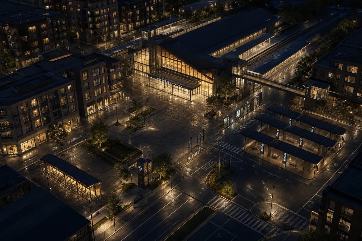
Create an unoccupied materially resolved photoreal oblique aerial concept visualization of a transit quarter after dark, centered on a regional station, bus court, housing, and a modest public square. Use sheltered entrances, canopies, clear wayfinding through architecture, dark masonry, matte metal, transparent ground floors, and localized wet pavement. Light routes, platforms, doors, and bicycle parking with practical warm fixtures while retaining dark roofs and sky. Frame a restrained medium-altitude view with visible shadow detail, making the station hall the primary pool of light, the square the central dark void, and the housing edges a subdued frame. Show no people; do not generate a crowd, queue, group, gathering, commuters, or human silhouettes. Include no moving trains, buses, bicycles, service vehicles, or road traffic. Keep track zones, crossings, and service access legible. Avoid floodlit facades and light spectacle. This is concept visualization, not planning, dimensional, engineering, regulatory, or construction evidence.
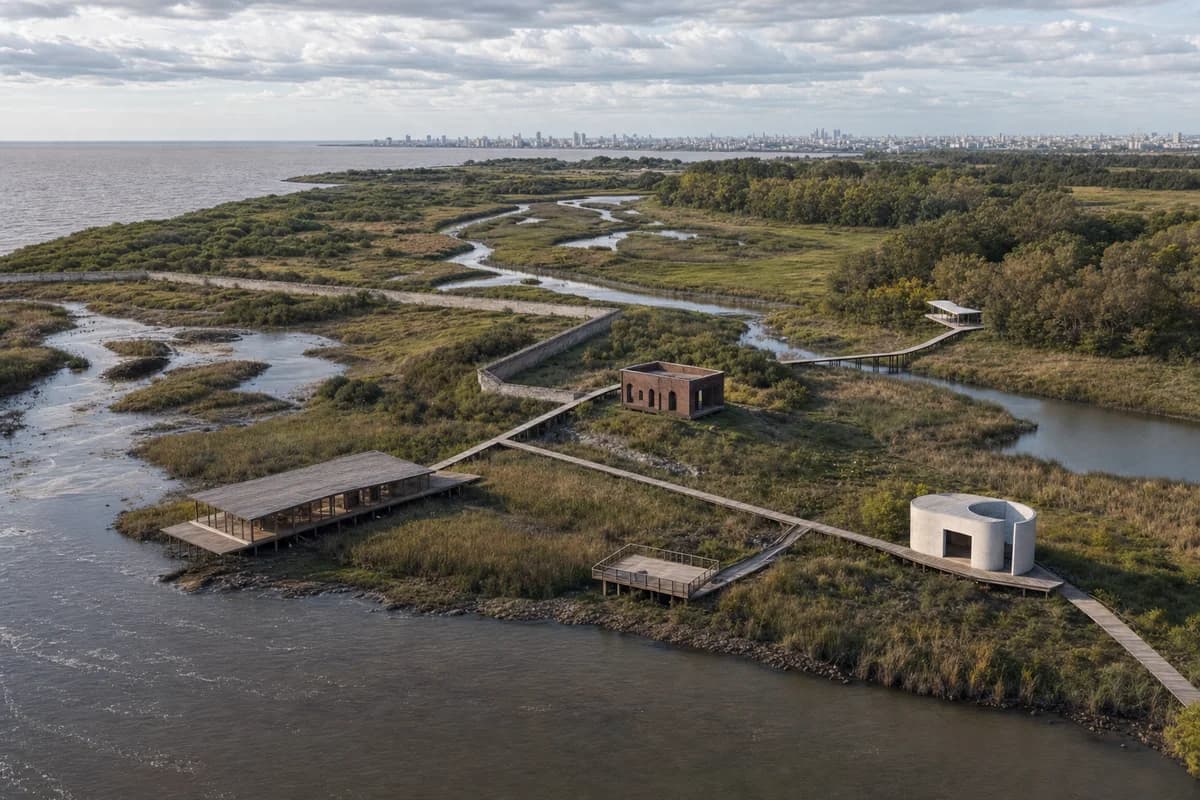
Landscape-led option review for a Buenos Aires tidal arts garden, habitat buffers, and hydrology.
Create an unoccupied materially resolved photoreal oblique aerial concept visualization of a tidal arts garden on the Río de la Plata edge of Buenos Aires. Retain branching water channels, wet grassland, woodland margins, and historic boundary traces. Add a low timber print gallery, a compact brick archive, a ceramic pavilion, raised walks, and two quiet observation terraces only along dry ecological transitions. Use weathered hardwood, pale regional stone, recycled aluminum, limecrete, dark brick, and modest protected foundations. Set changeable high cloud with natural atmospheric depth and frame a medium-altitude view across water toward the inland edge. Compose the archive as a small visual anchor, the three pavilions as separated points, and the raised walk as a thin connecting line within the larger landscape. Keep all paths, decks, pavilions, and visible rooms empty. Show no people; do not generate a crowd, queue, group, gathering, visitors, or human silhouettes. Include no vehicles. Make habitat buffers, tidal exchange, and discreet maintenance access dominant over buildings. Show no readable text, signs, logos, lettering, boards, or numbers. This is concept visualization, not planning, dimensional, ecological, engineering, regulatory, or construction evidence.
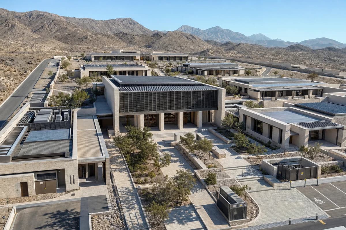
Review campus massing, shade, drainage, and phased expansion for a hot-dry research setting.
Create an ultra-real, architecture-first oblique aerial concept visualization of an unoccupied climate research campus on a gravel terrace outside Muscat. Arrange compact laboratories, a shared library, seminar rooms, and shaded circulation courts in stepped bands aligned with the terrain, using pale stone walls, low-carbon concrete frames, deep aluminum screens, protected timber soffits, roof catchments, and stone-lined infiltration channels. Set the campus beneath a bright, sunny, clear blue sky with warm direct morning sunlight and crisp shadows revealing structural bays, colonnade depth, roof falls, accessible routes, and service access. Frame a moderate-altitude aerial looking across the central library court toward the foothills, with every building edge and landscape system resolved as buildable detail. Keep all roofs, courts, paths, and visible rooms empty. Resolve solar control, drainage, expansion joints, emergency access, screened plant zones, and phased growth. Avoid resort imagery, monumental symmetry, ornamental water, token greenery, signs, branding, impossible spans, and named-designer references. This is architectural concept visualization, not dimensional, engineering, regulatory, or construction evidence.
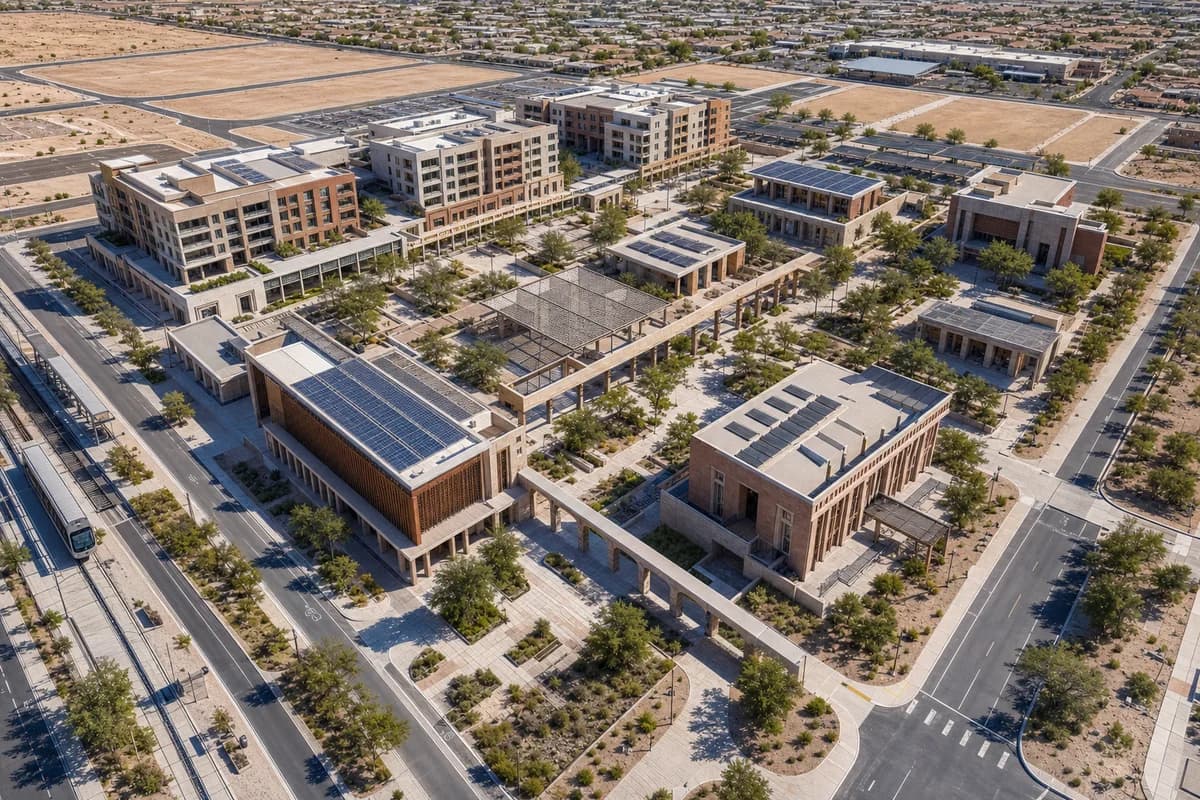
Evaluate a sun-protected civic district for public-realm continuity, access, servicing, and phased growth.
Create an ultra-real, architecture-first oblique aerial concept visualization of an unoccupied civic district at the edge of Phoenix, Arizona. Organize a library, health center, community arts hall, shaded transit court, and mid-rise housing around a connected sequence of arcades and planted public courts. Use robust masonry, architectural precast, perforated metal shade structures, regional stone paving, photovoltaic canopies, and drought-adapted planting tied directly to infiltration basins. Show a bright, sunny, clear blue sky with warm direct midday sunlight and crisp shadows mapping every arcade, canopy, stair, ramp, facade recess, and street edge. Frame a medium-altitude whole-district aerial that keeps adjacent blocks, transit access, service routes, and future infill parcels legible as buildable architecture. Keep all streets, courts, roofs, balconies, and visible interiors empty. Resolve continuous accessibility, emergency access, turning geometry, solar control, drainage, utilities, and phased construction. Avoid generic tech-campus imagery, heroic symmetry, decorative greenery, signs, branding, implausible cantilevers, and named-designer references. This is architectural concept visualization, not dimensional, engineering, regulatory, or construction evidence.
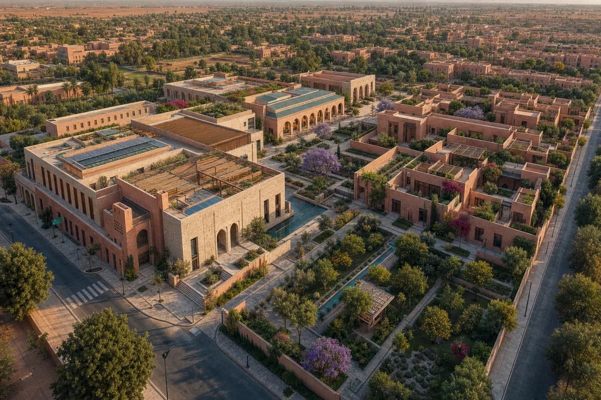
Present a refined civic district through landscape color, shaded urban form, and coherent public connections.
Create an ultra-real, architecture-first oblique aerial of an upscale civic garden district on the edge of Marrakech, arranged as a buildable sequence of a library, cultural hall, shaded residential courts, and a small public garden. Use rose-toned lime plaster, pale limestone, cedar screens, muted turquoise ceramic accents, and restrained woven awnings, balanced by jacaranda, citrus, bougainvillea, and deep-green courtyard planting. Frame a medium-altitude view at golden hour so warm inviting light reveals arcades, roof terraces, planted water channels, accessible routes, service access, drainage, and the clear hierarchy of streets and courts. Keep the district unoccupied and let architecture and richly colored landscape carry the scene. Make every span, wall thickness, roof edge, planting bed, and circulation connection credible. Exclude ostentation, kitsch, gaudy or garish color, gold-drenched surfaces, decorative clutter, theatrical excess, and impossible construction.
Visualize a landscape-rich tropical campus with refined color, clear academic organization, and credible climate response.
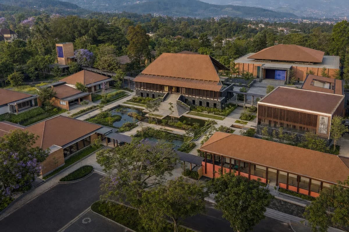
Create an ultra-real, architecture-first oblique aerial of an elegant arts and design campus in the green uplands of Bandung. Organize low classroom pavilions, a library, performance hall, gallery, and residential court around a chain of rain gardens and shaded pedestrian courts, using volcanic stone plinths, warm brick, dark timber screens, matte terracotta roofs, and carefully limited indigo, coral, and leaf-green accents. Enrich the landscape with flowering canopy trees, palms, ferns, and planted swales while keeping paths, fire access, covered links, drainage, and service routes fully buildable. Use warm clear late-afternoon light and a moderate-altitude campus view that makes the library court the visual center. Keep all buildings, paths, roofs, and visible rooms unoccupied. Exclude ostentation, kitsch, gaudy or garish color, gold-drenched surfaces, decorative clutter, theatrical excess, and impossible construction.
A neighborhood-scale housing concept organized around flood storage and compact dry ground.
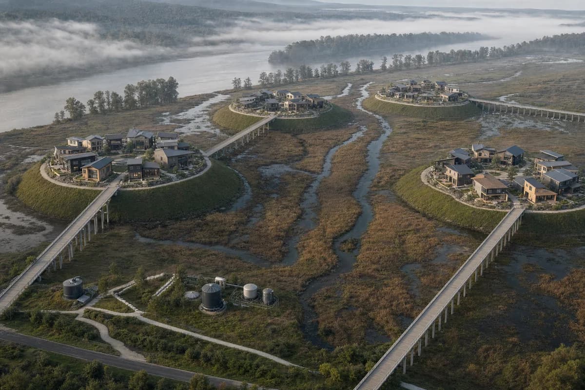
Create a photorealistic aerial-oblique concept for forty homes on a seasonal river floodplain. Form four to five dense housing clusters, each concentrated on its own distinct dry mound, and connect every cluster to safe ground by a direct raised evacuation spine. Separate the mounds with broad, uninterrupted flood-storage bands and retained drainage channels, with shared utility nodes and no construction inside the active river corridor. Use river mist clearing under neutral morning light. Frame a restrained 70mm aerial-oblique view that shows the entire hydrological structure without a map-like top-down angle. Keep every visible circulation route, threshold, terrace, and room unoccupied so structure, envelope depth, and material transitions remain the sole subject. Keep pier spacing, direct evacuation routes, utilities, landscape gradients, and water movement plausible. No resort cabins, decorative meandering boardwalks, fragmented flood-storage bands, untouched-nature fiction, boats as props, overbuilt common ground, or masterplan graphics.
An adaptable housing concept designed to provide dignity now and permanent reuse later.
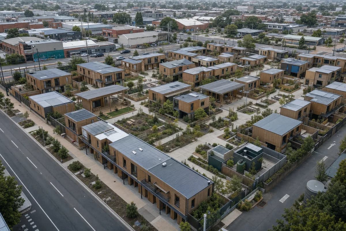
Create a photorealistic transitional housing campus for eighty families on an urban infill site. Arrange reusable timber room modules around several sheltered courts, with robust shared kitchens, childcare rooms, private garden thresholds, a clear public street, and compact service cores that can support later conversion to permanent housing. Use calm morning overcast and frame a 45mm elevated oblique view showing the whole campus without becoming a diagram. Keep every visible circulation route, threshold, terrace, and room unoccupied so structure, envelope depth, and material transitions remain the sole subject. Keep privacy, fire access, deliveries, drainage, play safety, and future adaptability plausible. Avoid emergency-camp imagery, identical containers, charity framing, crowded courtyards, token greenery, banners, or temporary-looking fabric.
A campus concept for modular laboratories, shared services, and phased expansion.
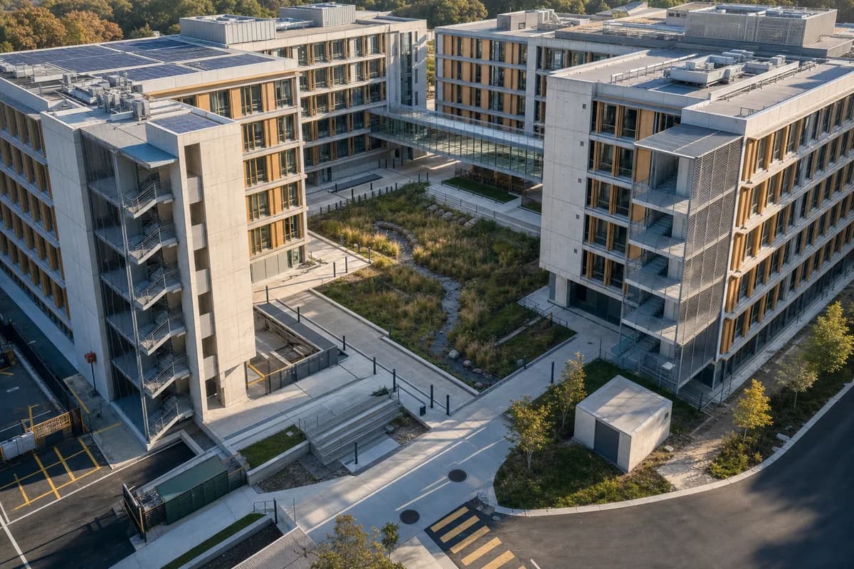
Create a photorealistic university science quadrangle formed by four five-storey modular buildings. Use repeatable timber laboratory bays, low-carbon concrete service spines, demountable glazed links, shaded external stairs, and a central rain garden that separates public and technical routes. Set clear early-morning light and frame a 45mm elevated diagonal view across the quad rather than a distant aerial. Keep every visible circulation route, threshold, terrace, and room unoccupied so structure, envelope depth, and material transitions remain the sole subject. Keep laboratory servicing, fire access, bridge spans, loading, drainage, and future expansion zones plausible. Avoid glowing laboratories, random modules, science-fiction equipment, branded banners, monumental symmetry, lush campus fantasy, or visual clutter.
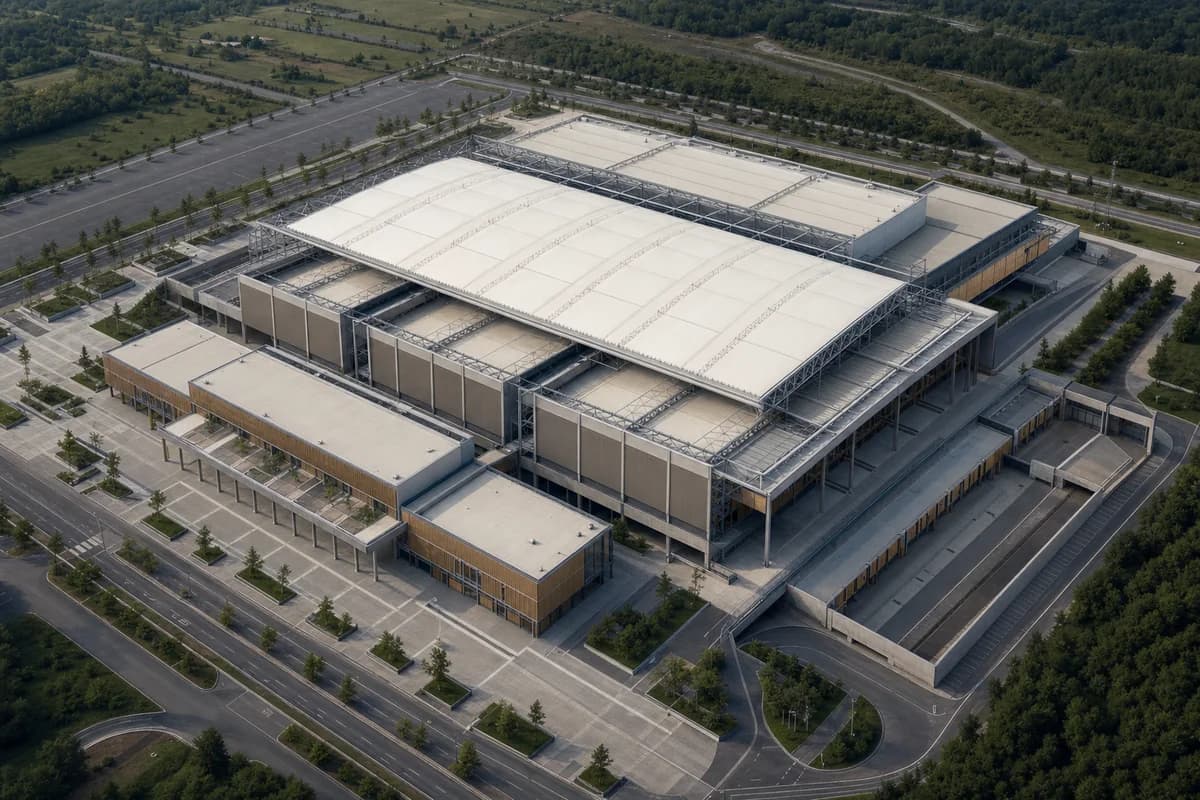
A large event-building concept for reusable structure, movable halls, and controlled servicing.
Create a photorealistic convention center for large events with phased disassembly. Use a reusable steel space frame, timber wall cassettes, movable acoustic halls, a serviceable fabric roof, compact loading courts, and a public foyer assembled from repeatable bays. Set clear afternoon light and frame a restrained 28mm aerial-oblique view that shows the whole complex and service edges. Keep every visible circulation route, threshold, terrace, and room unoccupied so structure, envelope depth, and material transitions remain the sole subject. Keep long-span depth, bracing, egress, loading, fabric drainage, acoustic separation, and component handling plausible. Avoid expo spectacle, glowing roof forms, branded banners, temporary-tent appearance, impossible spans, or futuristic transport.
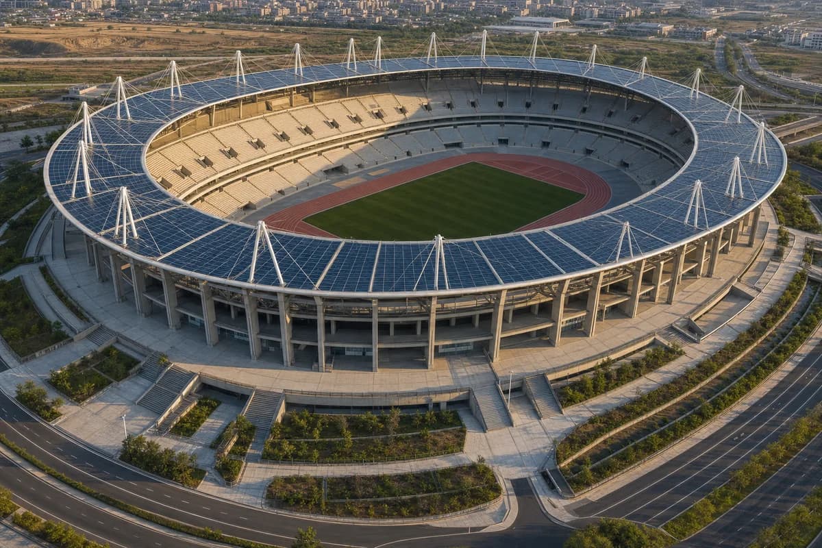
A stadium concept for canopy shade, solar collection, and legible long-span structure.
Create a photorealistic thirty-five-thousand-seat athletics stadium for a hot continental city. Use a precast seating bowl, cable-supported photovoltaic canopy, deeply shaded concourses, earth-cooled service rings, and a planted stormwater perimeter that does not obstruct high-capacity egress. Set dry late-afternoon light and frame a restrained 28mm aerial-oblique bowl view showing structure, track, and public approaches. Keep every visible circulation route, threshold, terrace, and room unoccupied so structure, envelope depth, and material transitions remain the sole subject. Keep sightlines, cable geometry, thermal movement, exit capacity, service access, and drainage plausible. Avoid flags, flame imagery, giant scoreboards, glowing canopy effects, parametric ornament, branded track colors, or impossible roof spans.
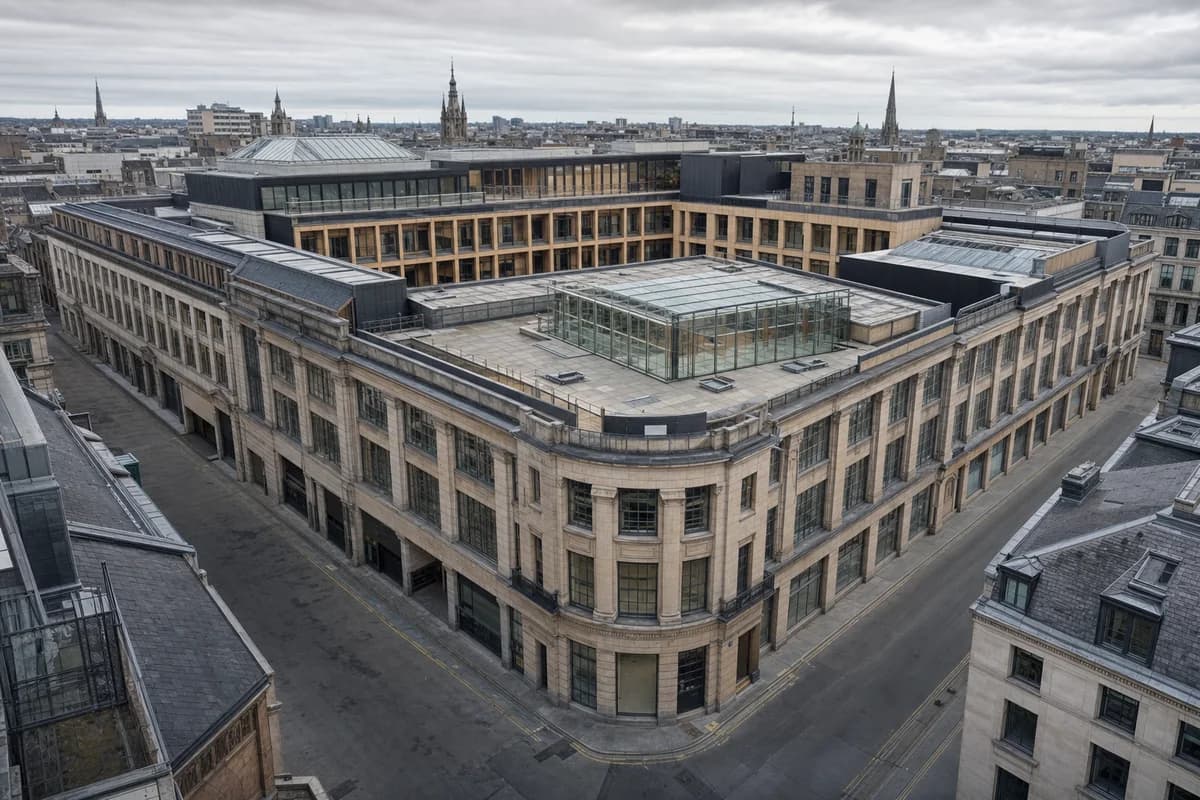
Visualize the adaptive conversion of a deep retail block.
Create an architecture-first photograph of a large European department-store conversion containing housing, studios, small shops, and a public winter garden. Retain the stone structural grid and deep floor plates while inserting timber courtyard facades, roof lights, clearly new circulation cores, and compact service zones. Use an oblique 60mm view from a neighboring building under high cloud, revealing the complete urban block and an empty winter-garden terrace with operable vents and drainage edges visible. Make fire separation, daylight penetration, deliveries, and old-to-new junctions credible; avoid luxury-retail staging, heritage pastiche, roof clutter, and wholesale facade replacement. Show a completely unoccupied visible scene: no pedestrians, human silhouettes, or vehicles anywhere in frame. Include no readable signs, logos, advertising, or transit branding, and do not depict any identifiable real venue.
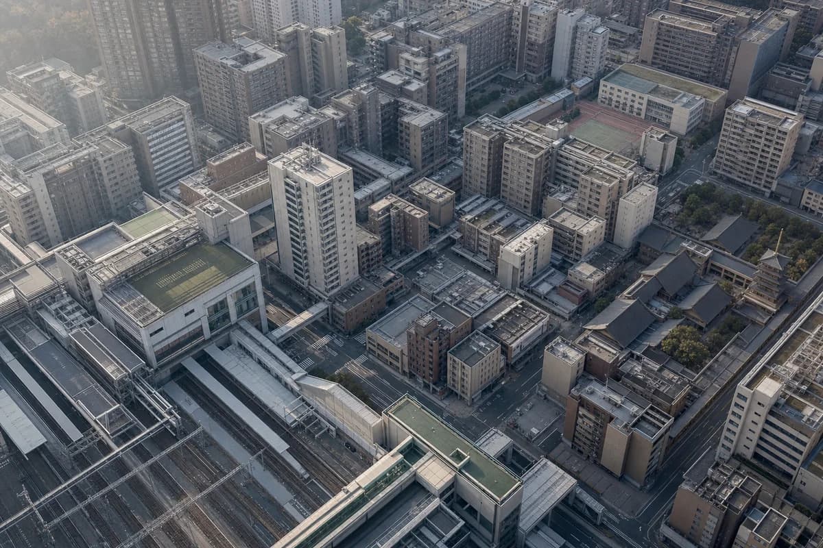
Illustrate the block structure and passages of a dense station district.
Create an architecture-first oblique aerial photograph of an East Asian station district formed by twelve- to twenty-story blocks, narrow courts, covered passages, schools, and one retained religious precinct. Use realistic concrete, ceramic, brick, and metal roofs under soft morning haze. Frame the station, block depths, service lanes, walking links, and transit transfers rather than a distant skyline. Keep crossings clear so rail geometry, fire access, daylight spacing, loading, and phased building ages remain credible. Avoid generic tower clusters, monumental axes, futuristic transport, excessive roof planting, perfect repetition, and map-like abstraction. Show a completely unoccupied visible scene: no pedestrians, human silhouettes, or vehicles anywhere in frame. Include no readable signs, logos, advertising, or transit branding, and do not depict any identifiable real venue.
Visualize a phased superblock retrofit into connected urban fabric.
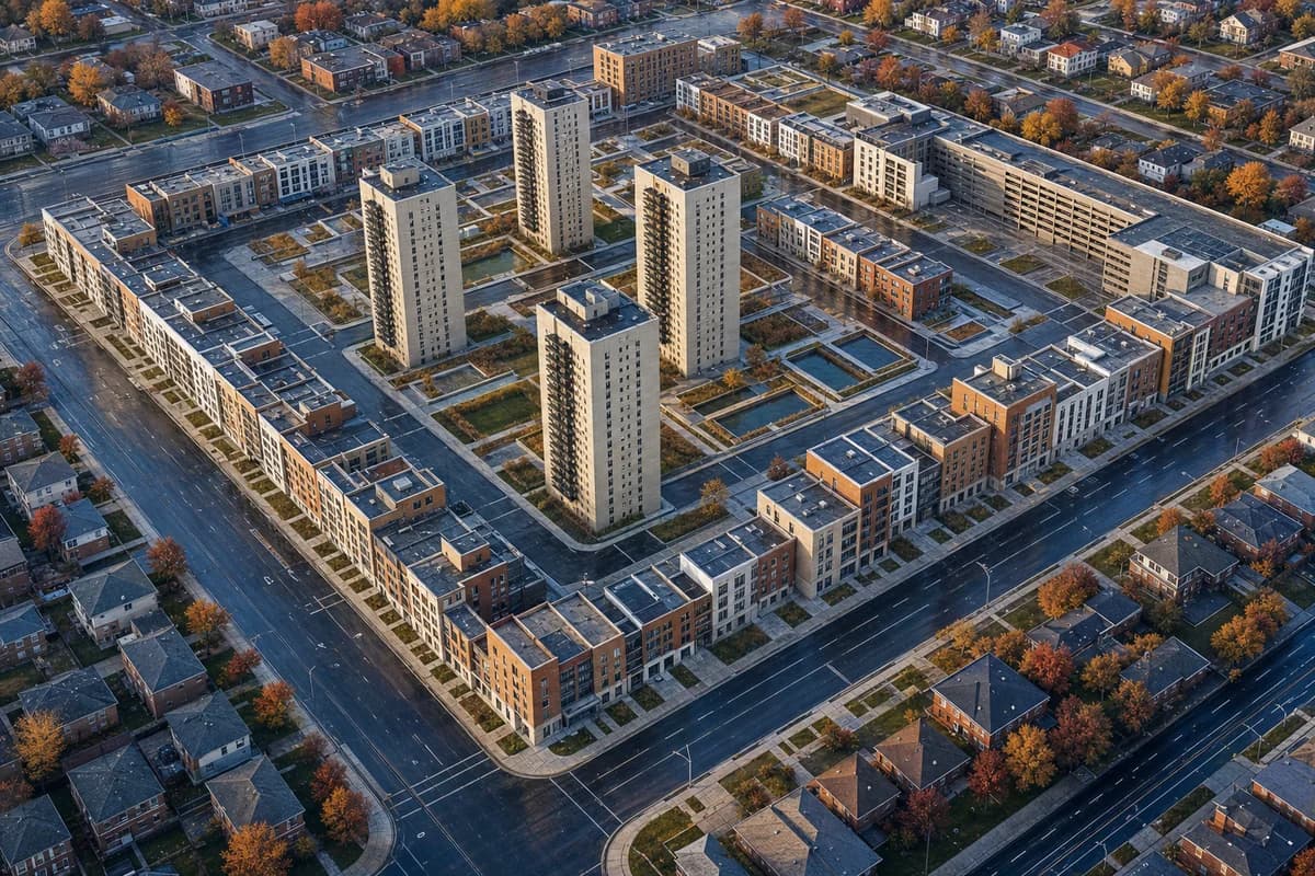
Create an architecture-first aerial photograph of a North American superblock retrofit. Retain four existing residential towers while adding mid-rise housing, civic rooms, new streets, stormwater courts, and structured parking wrapped by built perimeter edges. Use crisp autumn afternoon light after rain and frame one complete superblock from a moderate oblique angle. Use clear streets and courts to expose phasing, entrances, service access, block permeability, and relationships between old towers and new buildings. Avoid demolishing the existing structures, generic skyline imagery, decorative plazas, excessive greenery, autonomous vehicles, and uniform new construction. Show a completely unoccupied visible scene: no pedestrians, human silhouettes, or vehicles anywhere in frame. Include no readable signs, logos, advertising, or transit branding, and do not depict any identifiable real venue.
Illustrate a university quarter integrated with existing city streets.
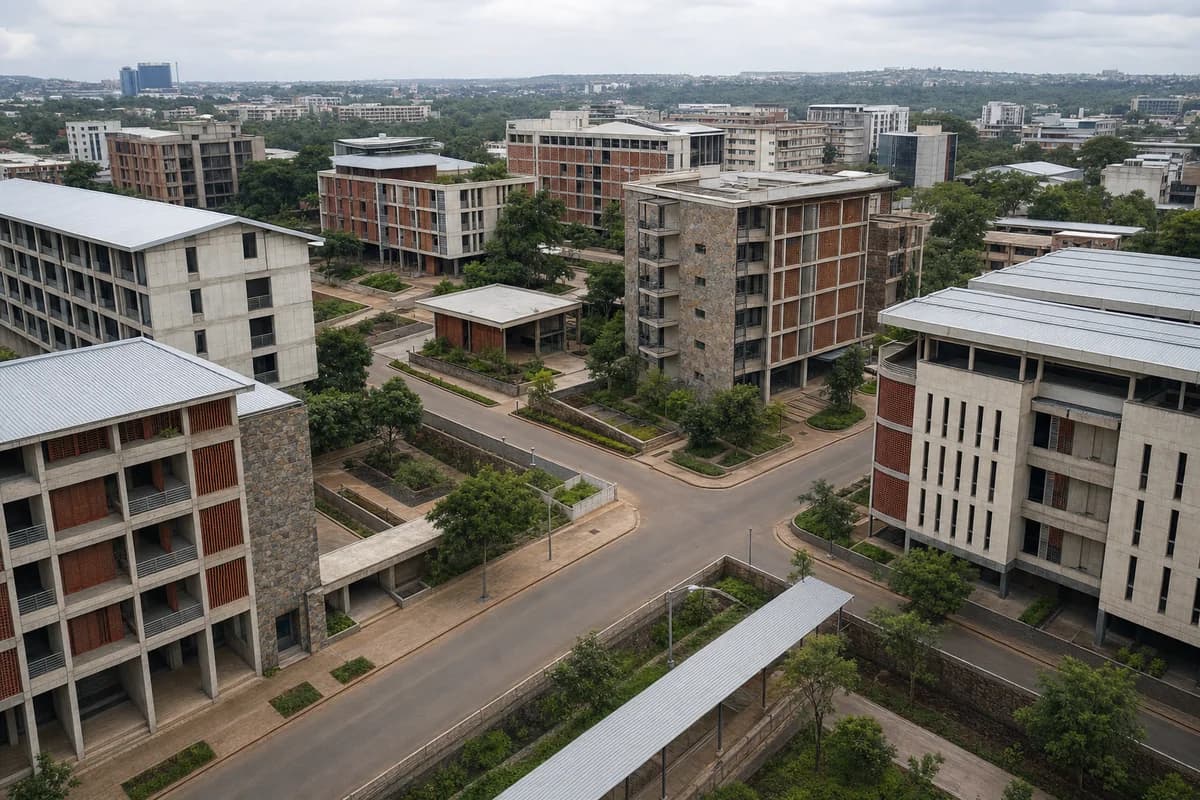
Create an architecture-first oblique district photograph of a sub-Saharan African metropolitan university quarter. Arrange shaded teaching blocks, residential halls, libraries, laboratories, transit stops, and narrow planted courts around retained city streets. Use concrete frames, clay screens, local stone, and light metal roofs in bright humid overcast. Keep buildings five to twelve stories and the central crossing clear so service access, security edges, shaded walking routes, drainage, expansion zones, and connections to neighboring blocks remain credible. Avoid isolated campus lawns, monumental axes, decorative patterns at aerial scale, technology symbolism, and generic high-rise backdrops. Show a completely unoccupied visible scene: no pedestrians, human silhouettes, or vehicles anywhere in frame. Include no readable signs, logos, advertising, or transit branding, and do not depict any identifiable real venue.
Study civic connections and retaining infrastructure across a hillside district.
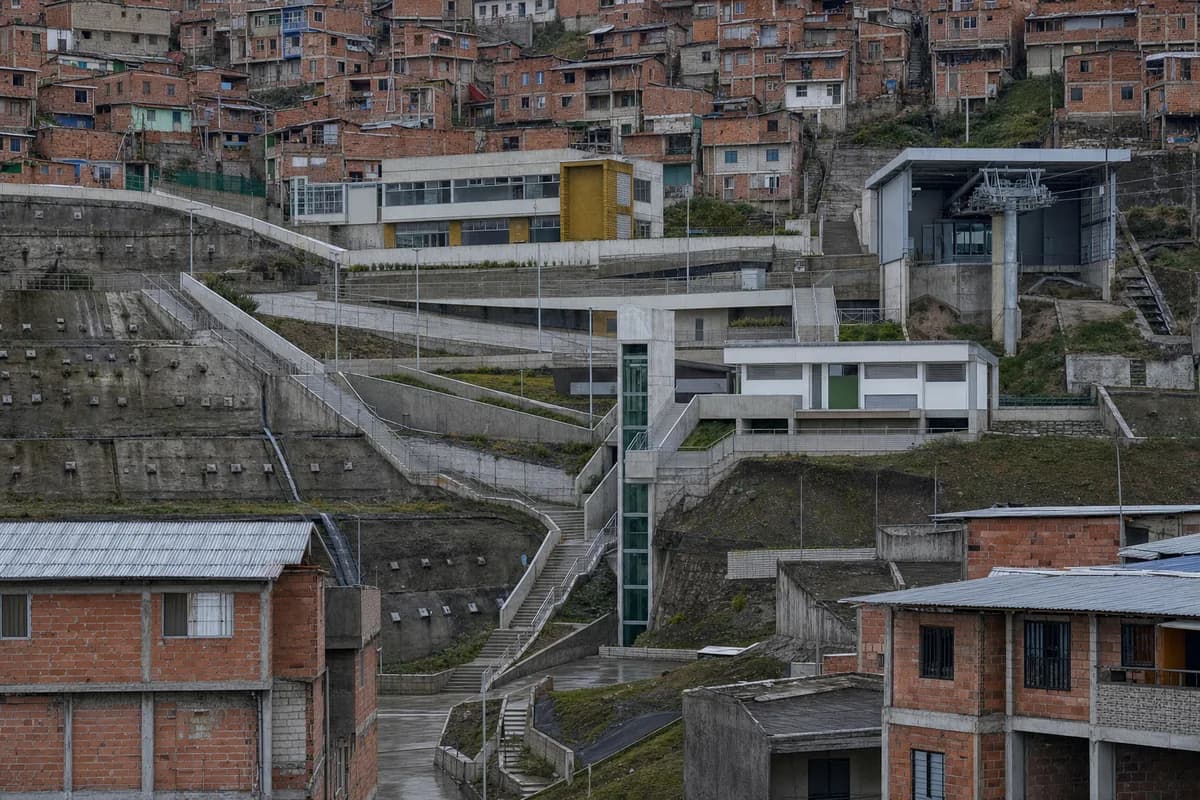
Create an architecture-first long-lens urban photograph of a steep Latin American hillside district. Compose dense brick and concrete housing around three new civic terraces containing a school, clinic, cable-car stop, and retaining infrastructure. Use a level 100mm view from the opposite slope after rain, keeping stairs, lifts, roofs, drainage channels, and service routes unobstructed. Make slope stabilization, emergency access, building depth, and connections to existing streets credible. Avoid picturesque informality, decorative murals, generalized skyline panorama, dramatic cable cars, excessive greenery, impossible retaining walls, and uniform redevelopment. Show a completely unoccupied visible scene: no pedestrians, human silhouettes, or vehicles anywhere in frame. Include no readable signs, logos, advertising, or transit branding, and do not depict any identifiable real venue.
Illustrate a flood-aware civic district organized by existing streets.
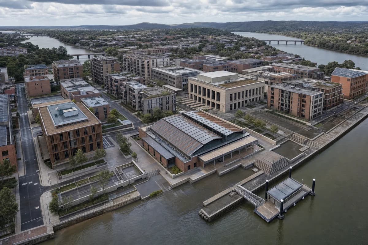
Create an architecture-first oblique aerial photograph of a compact Oceanian civic district at an urban river confluence. Arrange a library, courthouse, market hall, apartment blocks, ferry landing, and floodable public terraces around existing street alignments. Use recycled brick, architectural precast, timber roofs, and weathered metal beneath changeable afternoon cloud. Keep flood routes, block structure, service streets, and transit connections clear so finished-floor levels, emergency access, ferry geometry, and phased edges remain credible. Avoid iconic standalone objects, marina imagery, sweeping decorative plazas, decorative waterfront curves, generic skyline framing, and perfect masterplan uniformity. Show a completely unoccupied visible scene: no pedestrians, human silhouettes, or vehicles anywhere in frame. Include no readable signs, logos, advertising, or transit branding, and do not depict any identifiable real venue.
Jump to another corner of the library. Browse by building program and place, or by workflow and treatment.